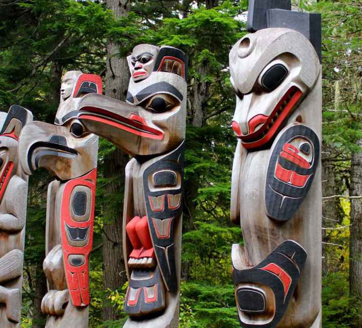
Kitselas Nation totem poles at the historic Kitselas Canyon site. Photo by Meaghan Hume.
In 2011, members of Kitselas Nation came together for a unique process to build consensus for land use planning within their territory.
Estimated Reading time

In 2011, members of Kitselas Nation came together for a unique process to build consensus for land use planning within their territory.
Kitselas Canyon
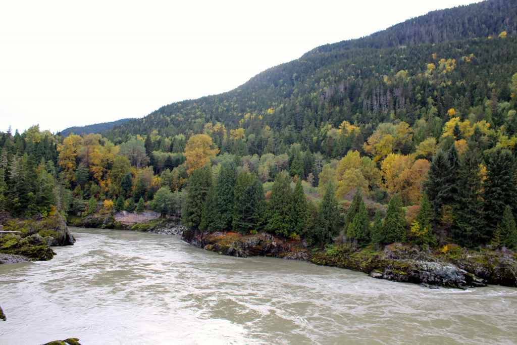
Kitselas Canyon is a historically significant area located along the Skeena River in the Northwest coastal region of BC.
Kitselas First Nation members are known as “The People of the Canyon” and their territory spans Kitselas Canyon along the Skeena River. This location provided their ancestors with food, transportation, and the opportunity to trade with other Nations.
The unique features of their territory continue to be closely tied to Nation’s cultural identity and in 2011 the Nation led a community-visioning process to ensure that future land use would continue to align with the Nation’s values. The Kitselas Master Land Use plan* was created through a deep level of engagement with youth, Elders, and community members to make planning durable as future development and stewardship work is implemented.
*The original Kitselas Master Land Use plan was developed in 2012. An updated 2019 version of the plan is included throughout.
For thousands of years, Kitselas people have occupied their territory and had their way of life shaped by the land. Their location in Kitselas Canyon enabled them to be trade intermediaries between neighbouring coastal and interior Nations, travel the Skeena River for resources, and provide transportation services across the river for travelers until the construction of the Grand Trunk Railway in 1912.
Our territory is truly our home—its unique character is part of us and ties us together as a Nation and a People.
The Kitselas Nation sees connection to traditional lands as vital to the health and prosperity of its people. Judy Gerow, Councillor, explains: “Our territory is truly our home—its unique character is part of us and ties us together as a Nation and a People.”
This connection was threatened in 1957 when a large fire destroyed the Nation’s main community and members had to relocate to neighbouring urban centres to access services and opportunities. The dispersal of the population meant Kitselas members had less opportunity to visit their territory and maintain cultural ties to their land and each other.
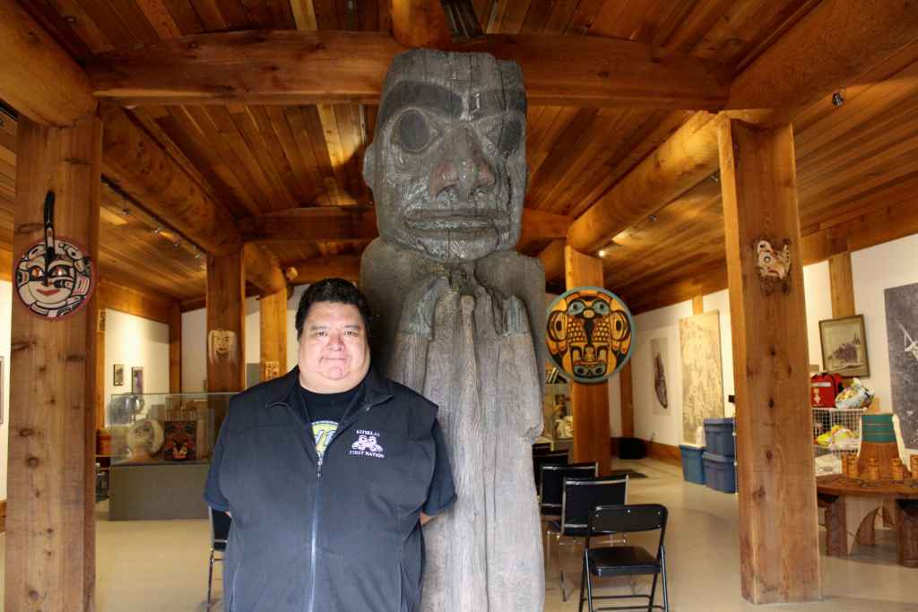
To counter the loss of members in their territory, the Nation’s leadership took proactive steps over many years to ensure that Kitselas territory was a place where its members could thrive and return to. “In 1960, there were no Kitselas members living on a Kitselas reserve,” explains Sam Coggins, the Kitselas Director of Lands and Resources. “However, in 2012, there were over 400 people living there again. This was the result of measures to foster healthy, working communities to bring Kitselas members back to the territory.”
The return of Kitselas people to the territory increased the need for long-term planning that would ensure the community could prosper. “While the Nation had passed land management laws, there was still a large gap in management policies that identified strategic development opportunities, as well as commitments to protect the conservation and cultural interests of its members on the land,” says Coggins.
The Land Use Planning process was an opportunity for the Nation to cement its intentions for traditional and cultural uses of their territory while also creating land designations to attract new economic opportunities and relationships with public and private organizations.
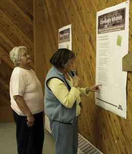
For development of the plan, Kitselas Lands and Resources management chose an inclusive approach to incorporate the diverse views of members and produce a truly community-owned plan. To accomplish this, the National Charrette Institute’s planning model was used. This process includes education, multiple opportunities for feedback, a visioning workshop, consultation, and final production of the formalized plan.
The planning was initiated with a community kick-off meeting for members to come together and create visions for each of the nine Kitselas reserves. This provided a forum for community members to identify priorities and objectives for each reserve. Further opportunities for anonymous feedback were arranged to ensure all community voices were represented.
“This was not just an opportunity to develop a plan, but to bring the community together, and to plan economic opportunities as well as conservation of important sites,” says Coggins. “Education, research and analysis were ongoing throughout the process.”
This was not just an opportunity to develop a plan, but to bring the community together, and to plan economic opportunities as well as conservation of important sites.
This approach was further achieved by educating members about the reserve lands the plans were being created for. “We traveled to each reserve to actually walk the lands we were planning for,” explains Sonja Foss, who compiled the plan.
This process served to introduce or reconnect members to remote areas of their territory. “We prepared a discussion piece on a different theme at each reserve to ensure the community understood the entire process. These topics covered the historical creation of reserves, approaches to land use planning, different kinds of resources, and the importance of land use controls and efficient government structure.”
The development of the plan ensured all voices were heard. “Communications gaps were bridged between the administration and community,” explains Foss. “Information about the history of the land and its current and potential uses was shared with young and old. Elders were involved in the planning process with the youth. Voices were heard that had never been heard in administrative decisions before.” The final result a community-derived land management tool to help guide future planning decisions by the Kitselas Nation.
The Kitselas Land Use Plan was originally published in 2012 and created designated zones and visions for the use and development of the Nation’s nine reserves. The plan represents a clear, consistent, and consolidated vision of how reserve lands and resources should be managed. The plan is accessible to staff, the community, and potential partners. It provides a road map for consultation with partners to address Kitselas Nation’s needs for effective implementation of proposals for development.
With the plan in place, the Kitselas community is able to move forward with development and conservation activities on its reserves. “Because the Land Use Plan was completed with the community, they decided what they wanted to do with certain areas,” explains Coggins. “We are now able to move forward with projects based on that plan.”
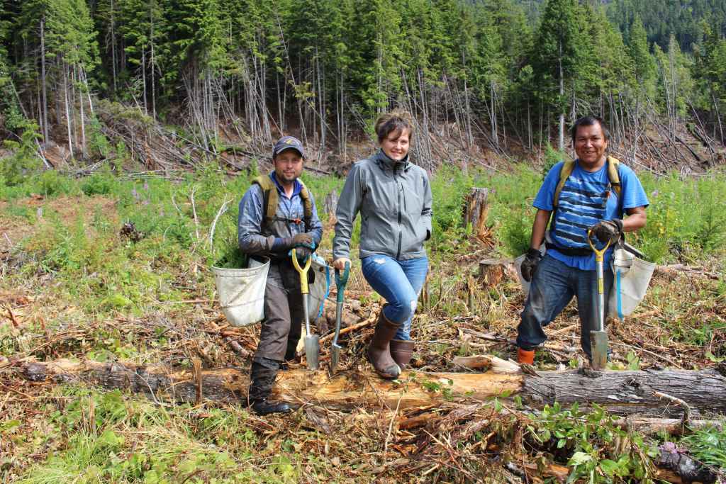
This has led to a reforestation project on Tsmdimaas reserve, which was zoned for resource use and protection of environmentally sensitive areas. “The plan gave us the community’s vision for this reserve,” says Coggins. “So, from there we were able to come up with feasibility plans for restoration and other work to present to the community, which led to the current restoration project for reforestation of the area.”
Strong ties in this place are a foundation to our culture’s reawakening.
As well as laying out the ground work for future plans, the actual process of developing the Kitselas Land Use Plan has become a model for how to effectively engage members in future decisions by establishing a successful precedent for deriving community-led input. “For the restoration project, much like the land use planning process with the Charrette, there was community involvement all the way through,” explains Coggins.
This approach ensures that the community’s connection to the territory and their vision for its growth will continue to support the revival of Kitselas territory, explains Gerow. “Strong ties in this place are a foundation to our culture’s reawakening.”
Investing Time for Sustained Results
The high level of community feedback fostered by the National Charrette Institute’s planning process required multiple meetings for member participation and educational workshops on the planning process. This method took over a year to complete, but the results were worth it: “The ongoing involvement of the community made this process very worthwhile,” says Coggins. “It has produced a truly community-derived plan. But it wasn’t fully implemented overnight — it is a process which takes months.”
Needing Key Human Resources
Recruiting candidates with the required technical knowledge for land development and planning projects in rural areas is a challenge. One solution Kitselas identified was to have existing staff complete the National Charrette Institute training and certification to enable the process to be done in-house.
Sourcing staff invested in the land-use planning process over the long term elevates the projects that can be taken on. “We are now in the process of formalizing much of the Land Use Plan into bylaws,” says Coggins. “That process has taken some time because key staff members needed to be recruited first. We are finally in the position where we can move forward on that now.”
The Kitselas Land Use Plan establishes priorities and guidelines to foster complementary uses of designated reserve areas with external government agencies, industry partners for development, and tourism opportunities to create revenue streams.
The process of establishing priorities and guidelines is also underway through the restoration projects to enhance Kitselas land resources, as well as build the capacity of local workers to engage in future proposed projects in the area. It has also enabled a partnership with Natural Resources Canada that draws significant funding to the community to prepare the Nation for an active role in planned resource development projects.
Learn more about economic partnerships.
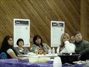
The planning process incorporated the cultural and traditional uses of territories in order to preserve these traditions moving forward. In particular, Elders offered support and guidance during the consultation process, and youth learned about traditional land uses from this. “The support and guidance of Elders was incredibly important in the process,” says Foss. “Youth were present at the events to learn from Elders, and they also played a key support role and contributed great ideas.”
Through field trips to different areas of the territory, community members rediscovered and increased their understanding of various aspects of the reserves and natural resources available. The subsequent forest restoration project on Tsmdimaas includes a key component of establishing wild berry fields to support traditional gathering of foods and medicines in the area once it is restored.
Learn more about Elders and Youth.
The Land Use Plan serves to align land use priorities with the unique features of the nine existing reserves in Kitselas territories, and the Kitselas Land Use Plan Advisory Committee was established as part of this project.
The plan identifies environmentally sensitive areas to be protected from development, such as protecting the Skeena River from development within 50 meters of the river bank. The plan also protects other water bodies, forests, traditional harvesting sites, wetland and other environmentally sensitive areas within reserves.
Additionally, the plan identifies areas designated for potential restoration work, which led to a reforestation project in 2015 that is improving habitat for a number of species.
Learn more about restoration.
The project brought the community together and created consensus and a shared vision through research and analysis, field trips, consultation, and National Charrette Institute workshops — community voices were incorporated throughout the entire process. The land use planning process was not simply focused on the creation of a plan, but most importantly on a deep level of engagement with youth, Elders, and community members.
Community members received education and training throughout the process on land use planning, resource management, and the traditional uses of the territory which ensured the planning would be durable as future development and stewardship work is implemented.
Learn more about training.
In 2010, Coast Conservation Endowment Fund Foundation approved a total of $9,277 toward this project.
Published On April 14, 2015 | Edited On March 13, 2026
